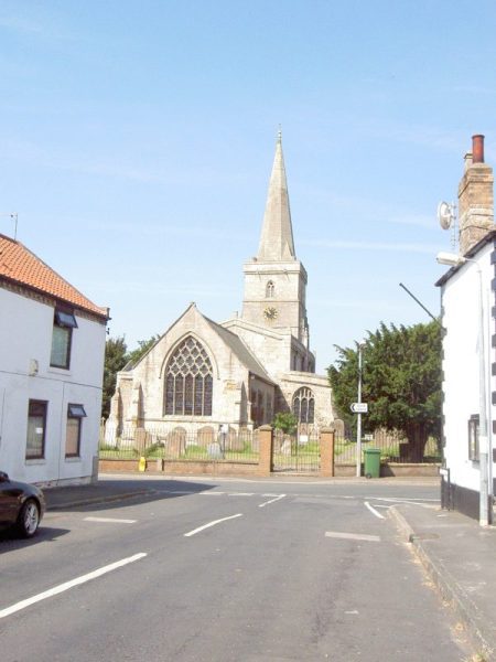
Most of the historic villages of Holderness took the form of linear settlements, i.e. building plots straddling a road or lane, or villages around a simple grid-plan, i.e. building plots alongside a routeway with the entrances to the land at the rear of the plot becoming a lane itself. Ottringham is an example of the latter although the short lane shown above runs crossways to the main ‘arms’ of the grid.
Having discussed the development of natural vegetation woodland (s.p.b.) on the post-glacial soils Prof. English (s.p.b.s) states that ‘Few of these wood-lands lasted into the Norman era’ (i.e. 11th -14th centuries) and she goes on to state that ‘Little of the ancient landscape of water, marsh and wood survives in Holderness today (1980s and even less so in the 21st century), and it requires an effort of imagination to reconstruct the appearance of the country before it was drained’. This invites some thought on the process by which this may have happened between, say, 4000B.C. and the 12th century, a timespan of perhaps 200 generations. This, of course, was a very long time but the pace of technological change was slow by later standards. Furthermore, most of the woodland clearance may well have happened pre 6th century as the Anglo-Saxon colonists would have needed large tracts of relatively open land on which to develop the characteristic ‘two-field’ openfield and common system of land allocation. So a follow-up question(s) might be to what extent , and by what means, was the natural vegetation on these fertile claylands reduced by prehistoric settlers – and indeed, to what extent was the forest clearance of, say, the Anglo-Saxons a destruction of seconday colonisation by Nature after some form of earlier ‘slash and burn’ treatment? The deciduous trees native to Holderness would have allowed a relatively thick undergrowth to develop, the beech with its dense leaf-canopy being more suited to calcarious soils.
(to be continued)