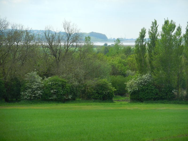
Recently went on a walk up and down some vales and wolds on the southern edge of the Yorkshire Wolds which afforded some panoramic views over the Humber. Starting on Beverley Road, South Cave walked a section of the Wolds Way long distance footpath to Mount Airy Farm. The view above, taken just before reaching the farm, shows the upper Humber, Trent Falls and the mouth of the River Ouse. The scarp slope in the distance is the northern edge of the Lincolnshire ‘Heights’ (limestone escarpment) with Alkborough village at the top of the scarp slope and Whitton at its most northerly point. Alkborough ‘Flats’, at the base of the scarp slope and beside the mouth of the River Trent, is now an area of ‘managed retreat’ having previously been reclaimed arable land.
From Mount Airy Farm walked round Wood-dale Plantation, over Ellerker North Wold on a section of the High Hunsley Circuit footpath, down the road through Brantingham Dale to Brantingham church before striking over Brantingham Wold, through linear woodland down the wold-side, past the grounds of Brantinghamthorpe Park before crossing the A63. It is difficult to construct a circular walk exclusively over wold and vale in this area so to complete this circular route walked into Elloughton, through the golf course, alongside the ‘Roman Road’ towards South Cave but diverted to a footpath which followed foeld headlands to Ellerker village. From ther a series of pavements beside busy roads and through South Cave itself.