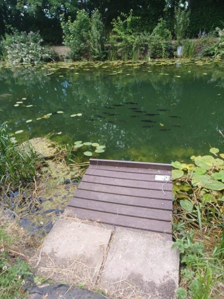
(Again this problem of pictures going sideways which I cannot solve). The photo above shows a section of Beverley Beck with a shoal (‘school’) of the type of fish that dominate this watercourse which look like small sharks, clearly they are not, but what are they? This was taken on one of those very hot afternoons last week, the platform is one installed for fishing from.
The Beverley Beck watercourse is now fresh water, this since a lock was created in the 19th century at its junction with the River Hull, east of Beverley. Previous to that the Beck would have been tidal, like this mid stretch of the River Hull, so that any pre-19th century sailing craft would have to await the flow tide in the Humber Estuary to sail the length of the Beck. This was a common issue for vessels in tidal waters and often vessels would rest on the bed of the watercourse until the turned tide brought in sufficient water for them to set-sail again.
Although Beverley Beck does not reach the site of Beverley Minster it was created, probably as far back as the 12th century, so that building stone could be brought as near as possible to the Minster site. If this dating is correct the stone so transported would have been for a building on the site of the present Minster, but which preceded the building seen today. Subsequent building programmes leading to the creation of the present building between the 13th and 15th centuries would have also relied on river transport for their building materials.
Beverley Beck was created by the canalisation of spring-head stream flowing from the base of the dip slope of the Yorkshire Wolds to the River Hull. The logistics of such civil engineering in the 12th century are mind-boggling.
Near the head waters of the Beck are terraces of mostly three-storey housing built about 20 years ago. On the north side all the small front gardens beside the waterside path have been thoughtfully planted and designed, this not always the case elsewhere.