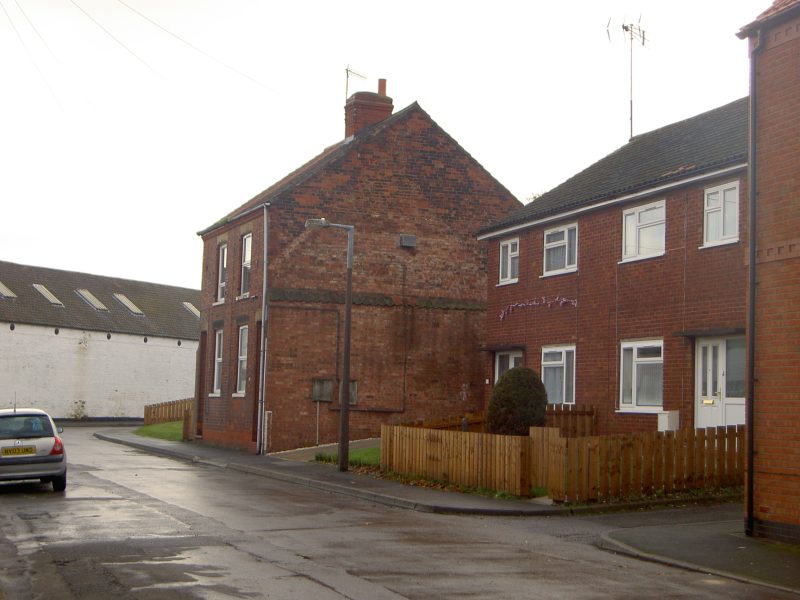
Following on from yesterday’s blog the photo. above shows the gable end wall of the two cottages on yesterday’s plan on the right and which still stand, the wall showing the outline of the end of the five adjoining cottages demolished in 1957. This shows that the five cottages opened onto the street/pavement (as do the surviving two) and that given their width they were probably two-up-two-down albeit with very small rooms. On the right is the pair of semis built in the late 1950s on the site of the five demolished, these with small front gardens (this not a common feature of earlier cottages built in Barton). The plans prepared ahead of demolition do not give details of internal arrangements or fixtures and fittings but they do give information on some external features, see yesterday’s plan. Each of the five cottages shared a communal back yard and each had an earth closet at the back of the yard while one only had a shed. At the back of the yard was a passage which enabled ‘night-soil’ collection to take place, there presumably being at least one rear gate.
The rectangular plot behind the passage is interesting, although not entirely relevant here. Here was the site of a partly stone-built building which had centuries before either been the site of a chantry, with altar, piscina etc, or had been the home of a chantry priest who served a chantry within St. Mary’s church, the churchyard of which abutted the ‘chantry house’. As seen in yesterday’s plan the access lane has retained the name Chantry Lane. Chantries were abolished in the reign of Edward VI and this ex-chantry house had served various functions over the years. Probably then in a derelict state, it was demolished along with the five cottages – brave new world.
(to be continued)