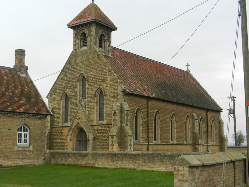
The photo above (also used yesterday) shows St. John’s church, sited between North Cliffe and South Cliffe. Built in 1873 in the Early English style of architecture it was commissioned by Samuel Fox, a Sheffield ironmaster, who had purchased the Cliffe estate. The nearby estate cottages are also of this time as are some of the isolated farmsteads out on Wallingfen, the one due west of the church and surrounded by a shelter-belt of trees being the one Fox lived in (I think). Standing in the churchyard and looking west and south one has expansive views of Wallingfen. St. John’s does not follow the standard orientation of most parish churches.
Being a difficult to penetrate wetland for hundreds of years Wallingfen formed the common land of parishes centred on settlements to all sides. This provided these communities with the resources of wetlands; fish, wildfowl,turves and summer grazing. Clearly, across such a large lowland area the parish boundaries could not have been clearly defined. A specific Enclosure Act of 1777 spurred-on plans for draining to create valuable arable land but, as seen with the Hull Valley and the Ancholme Valley, this resulted in major loss of habitat as well as parishioners common land rights.
Centuries ago such a large wetland area immediately west of the Yorkshire Wolds added to the isolation of the East Riding as, even if Wallingfen were crossed, the Wolds, before enclosure by the Sykes dynasty and other capitalist entrepreneurs, were difficult to cross with few recognised trackways. Little wonder that the people of the East Riding looked to the sea and Estuary to access opportunities beyond.
The settlements along the north bank of the River Ouse (s.p.b.) might trade beyond their locality by river, indeed Blacktoft retains a large jetty set into the foreshore of the River Ouse. Also in early medieval times the north levee bank of the River acted as a routeway west, although tide dependent.