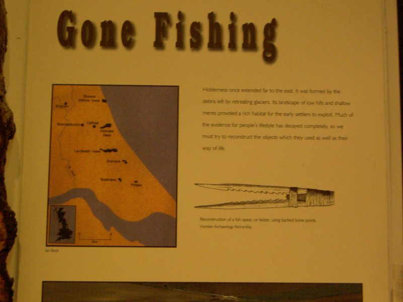
Above is a photo of part of an exhibit about fishing in Holderness taken in the Hull and East Riding Museum.
The Bulletin (s.p.b.s) concludes with what I always think is a good example of not taking place-names at face-value. Skipsea, Hornsea, Withernsea and Kilnsea are by the sea – but when these place-names were evolving they were not by the sea, it’s coastal erosion that has resulted in them now being beside the sea. So what did ‘sea’, or similar arrangements of letters, mean centuries ago? The answer fits-in well with our study because then it was derived from an ancient word for a water body or marsh – so these places were, centuries ago, near/beside a mere, but not the coast – since then their meres, except Hornsea, have been drained or lost to coastal erosion.
The Bulletin ends with, ‘Skipsea Brough provides another interesting example of a Holderness mere, but in this case the mere served as a moat for Skipsea Castle’. I recently received through the post Vol. 42 of ‘Landscape History’, the journal of the Society for Landscape Studies. The second article by Elaine Jamieson is entitled ‘Landscape, Place and Identity: The Castles of the Holderness Plain’. Will hope to write about this when I have read it.
As previously stated I now need to summarise the last chapter of Dr. Barbara English’s book ‘The Lords of Holderness'(1979, Oxford University Press), the last chapter fitting our theme and entitled ‘Land and People’. Although the book is mainly concerned with the doings of successive Lords of Holderness this final chapter is a good summary of many points relating to the historical geography of Holderness.
But lastly for this blog it is interesting to note that the Holderness coastline between Spurn Point and Bridlington constitutes a third of Yorkshire’s coastline, this extending north to Boulby cliffs, south of Redcar and Teeside.
(to be continued)