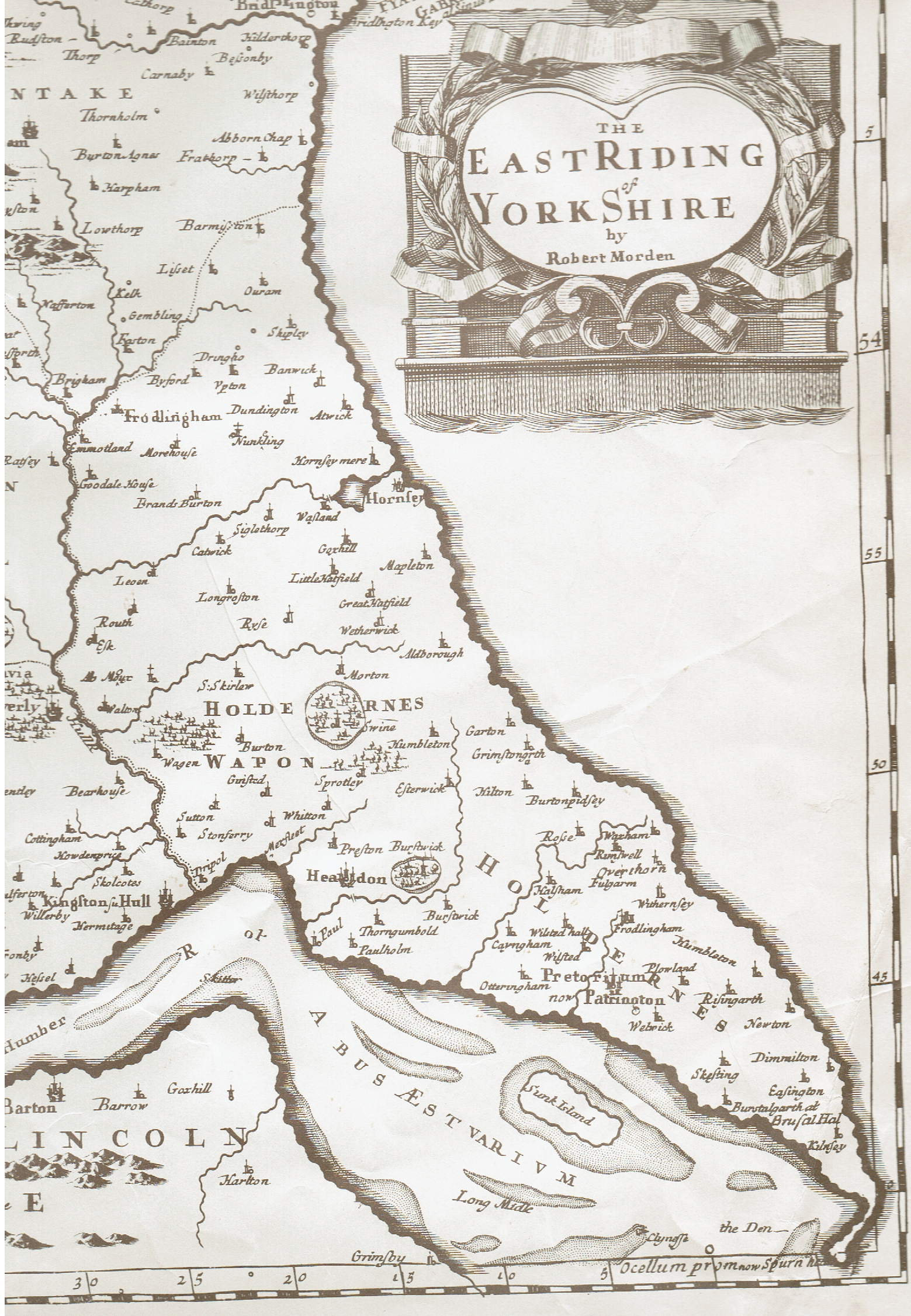
The extract from Robert Morden’s map of the East Riding published 1695, see above, makes the point clearly (s.p.b.). A series of rivers in central Holderness flowed west-south-west to become tributaries of the River Hull even though the sources of these rivers were close to the coastline. In south Holderness a series of streams flowed south-west to exit directly into the Humber Estuary, the north bank of the Estuary then being much further north behind the sandbanks of what was to become Cherry Cobb Sands and Sunk Island. The streams of Holderness flowing into the River Hull were seen as beneficial by the Corporation of Hull as, although they carried silt into the River, they added to the volume of water that ‘scoured’ the ‘Old Port’ at ebb tide thus helping to keep a depth of water in the lower River Hull suitable for shipping movements.
Two factors have changed the drainage pattern of Holderness since the 17th century;
(a) the capture of the headwaters of the streams shown on the map extract above by coastal erosion,
(b) the diversion of drainage waters from the natural channels shown above by large scale man-made drainage channels.
In her study ‘The Draining of the Hull Valley’ (East Yorkshire Local History Society, 1958, reprinted 1976) June Sheppard dealt also with the man-made drainage channels along the western fringe of Holderness, these capturing the waters of some of the west flowing streams (s.p.b.s) and carrying these waters initially to the lower River Hull near Drypool Bridge. Incidentally, although the drain has been long filled-in two bridge parapets, built of encaustic brick, survive at the southern end of Cleveland St., this once being a bridge over Holderness Drain, I think, needs confirmation.
At the time of the opening of King George Dock, 1914, a newly dug spur carried the waters of the Holderness Drain directly to the Humber.
(to be continued)