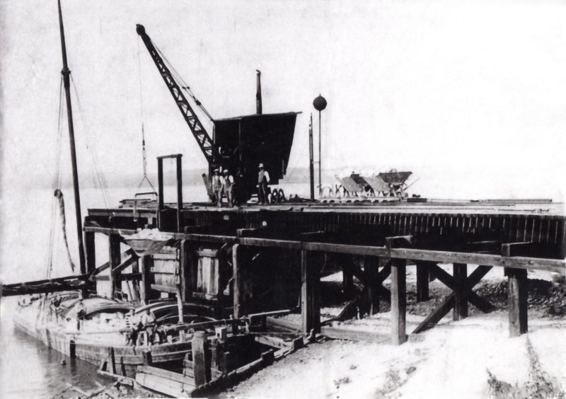
The fact that the Humber Estuary bisected the ‘Ferriby chalk’ escarpment has meant that the side of the Humber valley immediately east of the boulder clay ‘Cliffs’ has been an ideal location for quarrying the chalk rock. By driving a level-floored cutting into the valley side an increasingly deep wall of chalk was revealed and quarried back or side-wards. Furthermore, by constructing wooden piled jetties into the Humber foreshore and on a level with the quarry floor it was possble to transport the bulky quarried material by boat (keels or slopes). The photo above, originally in the collection of Brian Peeps of Barton now, I think, in Barton Civic Soc. archives, shows the once jetty at Leggott’s Quarry (s.p.b.) and rail trucks ready to tip their load of chalk into the hold of a waiting barge. The date of this picture is uncertain but is almost certainly inter-War. The jetty shown is now derelict.
Chalk quarries were in fact excavated for a number of purposes. Parish quarries were excavated by vestries (see earlier blogs on local government through the ages) to provide hard-core for road repairs and possibly building foundations. Like field quarries (see later), these were usually relatively small quarries. Two examples survive on the south bank; the one on the left, now wooded, going down the scarp slope into South Ferriby from Barton on the A1077 and the relatively large example on the right going out of Barton on the road to Barrow, this now the site of a small housing estate built on the quarry floor. I dont know of the locations on the north bank but parishes such as North Ferriby and Swanland would have had them. Have just remembered that the once parish quarry in Hessle is a good example being the quarry with allotments in it beside the road to North Ferriby coming out of The Weir area of Hessle.