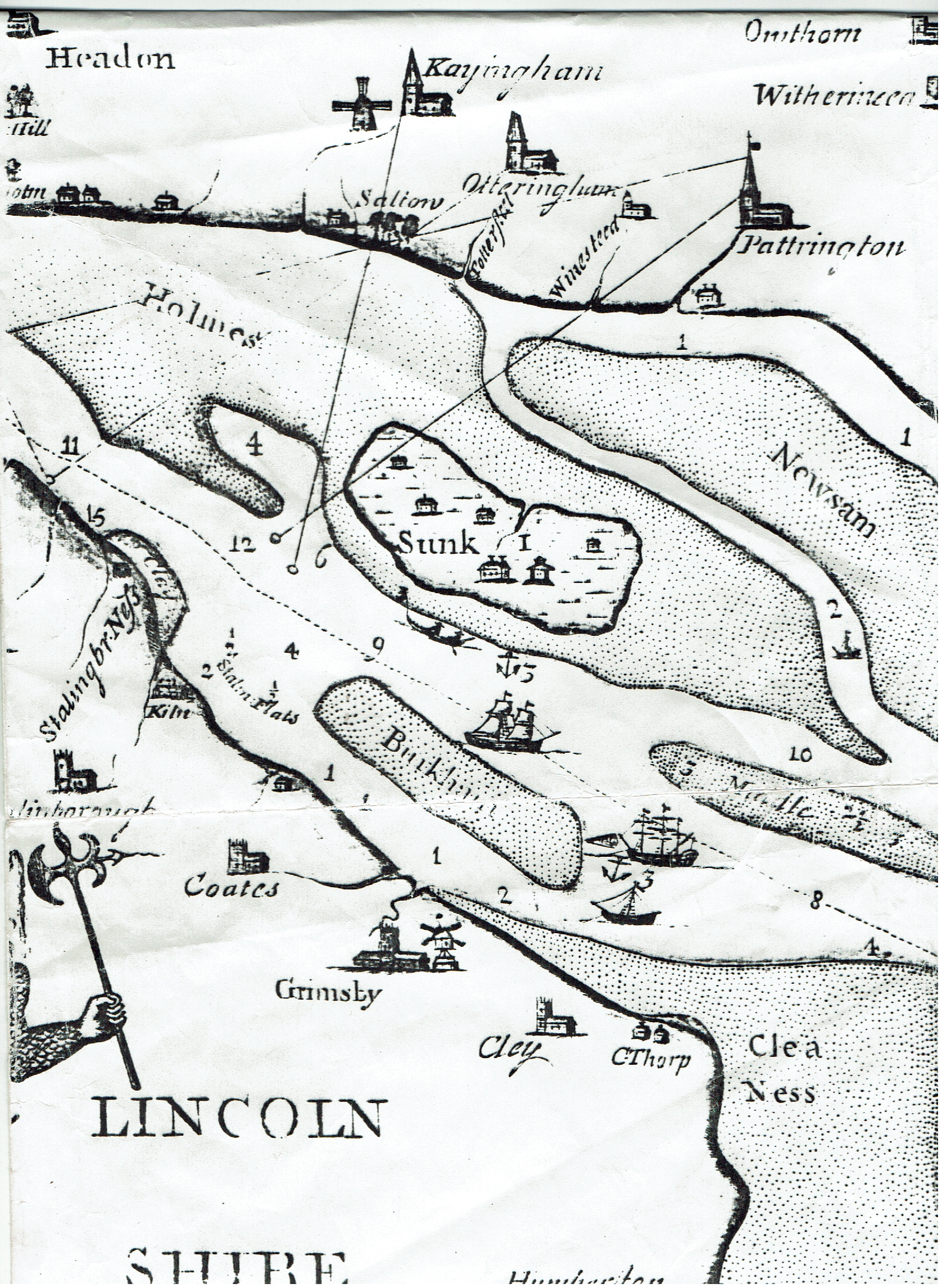
This third extract from Scott’s 18th century navigational map shows the area of the lower Humber Estuary between Grimsby on the south bank and Easington on the north. It shows the then Sunk Island to be an inhabited island surrounded by vast mudflats at low tide with a shallow but navigable channel (drawing of a ship) up to Patrington Haven (port). Today virtually all the area shown as mudflats adjacent to the north bank is now reclaimed land and intensively farmed, the drain leading from Patrington Haven now a drainage channel.
Where the deep-water channel rubbed-up against the south bank (left edge of extract and see channel depths in fathoms) is where the port of Immingham was developed in the early 20th century it being in a very similar site to the port of Hull vis-a-vis the deep-water channel. The forerunner of Cleethorpes was a mooring for fishing boats some way from the heart of the historic village of Clee.
All the churches shown here and elsewhere on Scoot’s map are discussed in the context of historic aids to navigation in my extended article ‘Landmarks and Beacons’ – see Section 3 of this website.