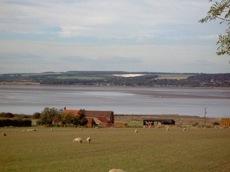
Another view from the same point as two blogs back, view north-north-east across the Estuary to the southern Yorkshire Wolds beyond. The farm-house and buildings centre known as ‘Poor Farm’, not because of the poverty of the farmer but rather because it was owned by the Bluecoat Charity, an old charity which provided accommodation for poor children who were required to wear a blue-coloured uniform (see any information on the Charity in Beverley).
Just visible centre-right is North Ferriby cliff, a section of the Humber bank made of unconsolidated boulder clay easily eroded by under-cutting by spring tides. South Ferriby cliff is of the same composition and, before obliterated by marine erosion, was the site of a Romano-British settlement, probably the site of the south-bank ferry docking point from Bronze Age onwards (this an assumption based on the findings from the ‘Ferriby (North) boats). Clearly, if not the remains of a terminal moraine, this post glacial deposition feature once extended well out into the Estuary we see today.
In the distance Melton chalk quarry still, I think, excavated today. On the south bank to the right of the above scene are two adjacent Chalk quarries (no longer worked), the narrower of the two excavated to supply rock to the cement works that once existed on the Humber bank. To the left of the above scene Leggett’s quarry, just into South Ferriby parish, again no longer worked. My article on the history of the cement works is not yet uplifted to this website, details on the chalk quarries can be found in my extended illustrated essay entitled ‘Simplified Geology of the Humber region’ in section three of this website.
Centre-left the built expansion east of Brough and the expanding trading complex at Melton, like a maurauding horde threatening the exclusivity of North Ferriby from the west!