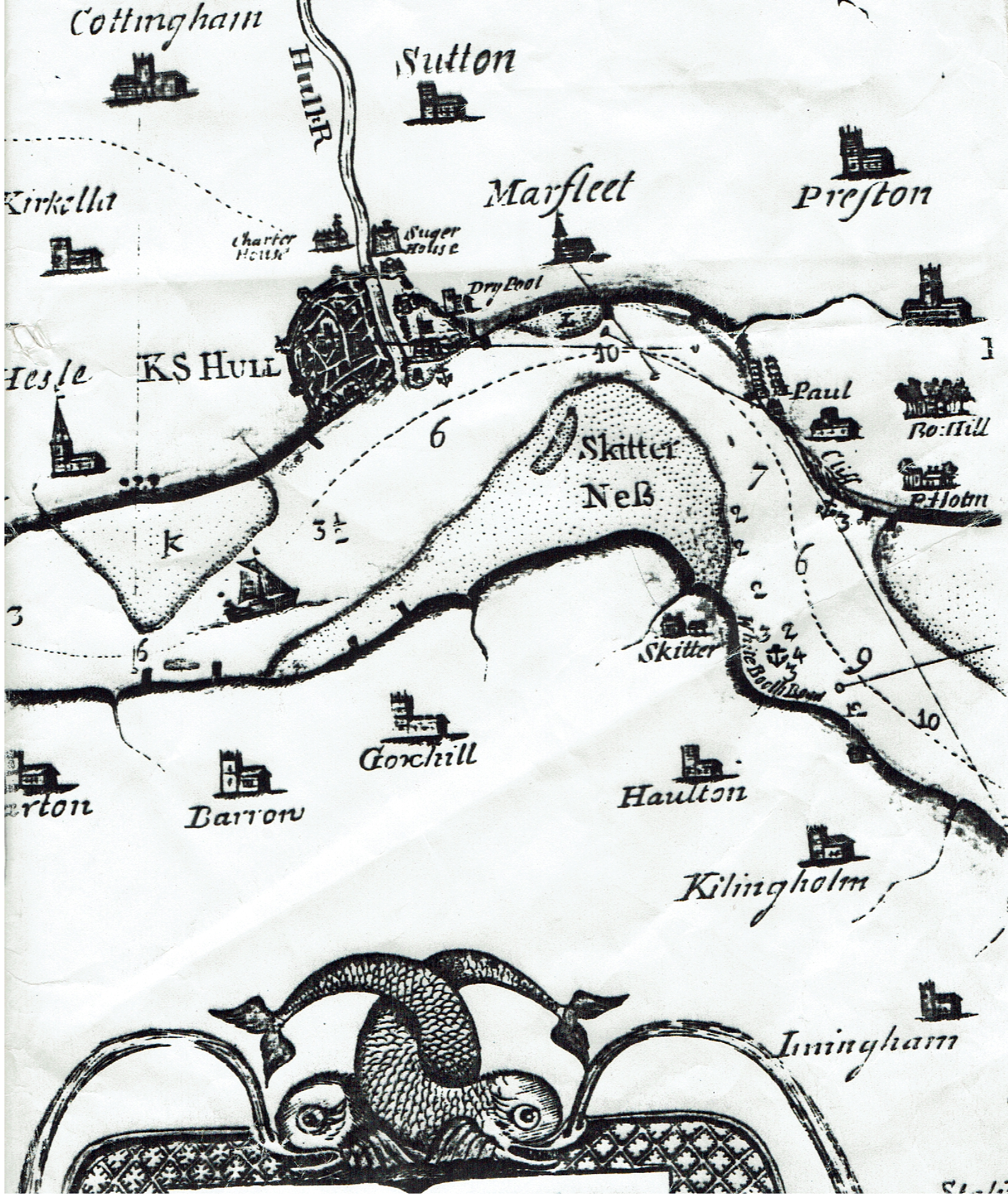
Today’s blog picture shows the middle reaches of the Humber Estuary as represented on Scott’s map of 1734. If just two references are used to define the Humber – upper and lower – then Hull is the dividing point. Shown clearly is the ‘dog-leg bend in the Estuary, this an unusual feature which I am pretty sure I have written about before, most estuaries are ‘trumpet shaped’. The depth in fathoms figures clearly show the importance of ‘Hull Roads’ (s.p.b.s), this a result of the ‘dog-leg’ configuration.
The map clearly shows Hull still confined in its medieval town walls, but by 1734 also defended by the Citadel in the parish of Drypool. Incidentally, also shown is the fact that immediately below the southern section of the town walls was the foreshore, land south of Humber St. today was to be subsequently reclaimed, whereas the projection on the east side of the mouth of the River Hull, later to be known as ‘Sammy’s Point’, did then exist. Also shown is that then (1734) the Charterhouse almshouses,in the parish of Sculcoates were well out of the town. Up to the Reformation this had been the site of the Carthusian monastery established by Michael De la Pole (s.p.b.s on monastic history).
The huge mudflat shown on Scott’s map as ‘Skitter Ness’ does not have an exact equivalent today although the inside of a meander, here the ‘dog-leg’ in the Humber, would be slower flowing water than on the outside and therefore more prone to deposition of silt.
A couple of observations about the Paull area (centre-right). Scott’s map shows two parallel rows of symbols which I assume to be cottages, the village, as today, detached from the church. Secondly, south-east of Paull church is a house-like building attached to a tower-like building. Today just the tower survives on Holme Hill, a listed building, I believe, but on private land.